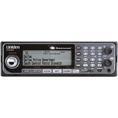
Uniden BCD536HP HomePatrol Series Digital Phase 2 Base/Mobile Scanner with HPDB and Wi-Fi. Simple Programming, TrunkTracker V, S.A.M.E. Emergency/Weather Alert. Covers USA and Canada.
The BCD536HP continues Uniden's tradition of leading innovation. Home Patrol Programming makes it the easiest-to-program mobile professional scanner we've ever made.
Plus, the Wi-Fi feature lets you use the exclusive Uniden Siren App on your smartphone or tablet to access your scanner from anywhere in your home or vehicle.
The 536HP digital Trunk Tracker V is the first full mobile/desktop unit that requires no user programming. Simply turn it on, enter your zip code and Trunk Tracker V does the rest.
This user friendly digital scanner will immediately begin receiving communications systems used by Public Safety, Police, Fire, EMS, Ambulance, Aircraft, Military, Weather, and more.
This functionality is made possible by combining the rich radio system database from Radio Reference with Uniden's patented radio system selection methods to correctly identify and monitor only nearby systems in the USA and Canada.
Scan by location allows you to set your location(s) by zip/postal code or GPS coordinates